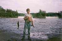
High Falls on the Namekagon
- a destroyed canoe and lessons learned
by Bryan Whitehead
June 7, 1997
 The
gathering plans had worked themselves out - but as usual with lots of wrinkles
and complications. My old friend Steve - a seasoned old school woodsman -
knew of an outstanding fishing campsite which he had frequented years earlier.
The location was on the Namakagon River, somewhat west of Quetico Park's boundary.
The directions as always with Steve were a bit hazy - a problem made more
acute since we were going up separately a day or so apart. I was driving a
borrowed van filled with my sons and another couple of boys... and was given
the task of driving up from Minneapolis overnight after picking up an retired
gentleman whom I had never met. My passenger was to be Bob, who was a pretty
elderly retired Cargill Senior executive and lifelong friend and mentor of
my buddy. After some trial and error we found his Central Minnesota summer
home on a small lake, added his well worn and carefully packed Duluth pack
to our load and headed north.
The
gathering plans had worked themselves out - but as usual with lots of wrinkles
and complications. My old friend Steve - a seasoned old school woodsman -
knew of an outstanding fishing campsite which he had frequented years earlier.
The location was on the Namakagon River, somewhat west of Quetico Park's boundary.
The directions as always with Steve were a bit hazy - a problem made more
acute since we were going up separately a day or so apart. I was driving a
borrowed van filled with my sons and another couple of boys... and was given
the task of driving up from Minneapolis overnight after picking up an retired
gentleman whom I had never met. My passenger was to be Bob, who was a pretty
elderly retired Cargill Senior executive and lifelong friend and mentor of
my buddy. After some trial and error we found his Central Minnesota summer
home on a small lake, added his well worn and carefully packed Duluth pack
to our load and headed north.
I set the boys up with a portable VCR and television that was powered by the 12 volt outlet. This is actually a pretty good way to keep a group of preteens quiet and occupied as we augured Northward thru the darkening fields and forests. The van was very heavily loaded and included a full roof rack with an amazing collection of stuff bungee corded and tied into place. The only time this additional load became a concern was when I narrowly missed a wandering deer on the dark highway south of International Falls. The locked brakes brought the weighty van to a screeching halt just a few feet from the yearling. A deer in the headlights indeed - I was worried that if the van didn't kill him the stove flying off the overhead rack might!
Dawn came after we crossed the border. We stopped to buy licenses and camping permits, bought some coffee in the early light and rolled on. Now, to say that the directions became more vague would be an understatement. I watched the odometer carefully. When we were close to 100 miles out of from Ft. Francis, I squinted and looked for a gravel road which should appear to my right. The problem was that there were numerous gravel roads leaving the asphalt to the right - to my eyes all looked identical. Bob - the friend we picked up however had been to this spot many times over his 70 some years. Based on his recollection, I turned and started down a dirt road that seemed to have no end. Mile after mile of washboarded dirt and gravel passed under the tires. The kids snoozed on as Bob calmly watched the trees slip past. I had absolutely no confidence that we were even in the right part of Canada... much less on the right unmarked gravel road. Bob was calmly unconcerned. I glanced over occasionally to make sure he was still awake. Forty miles or so of the rough gravel road faded to a boggy trail with two tire tracks marking the way through the groves of trees and vast wetlands. The oil pan occasionally bottomed out as I kept the van moving, fearful that if I stopped we'd never get it out of the sucking mud. AAA (CAA?) almost certainly wouldn't respond to a call, even if my cell phone had a signal- which it didn't. The speed we now traveled at was barely over walking pace. The open windows brought in dozens of ravenous mosquitoes which awakened the boys who began asking for breakfast as they swatted the bugs.
The only reassuring thing I could see at this point was that some other vehicle had recently been down this same trail. As my friend had decided to go ahead of us, I was marginally hopeful that these were his tire tracks.
